Valkyrie Solution for Smart Cities & Infrastructure
Download Valkyrie and try it for free now!
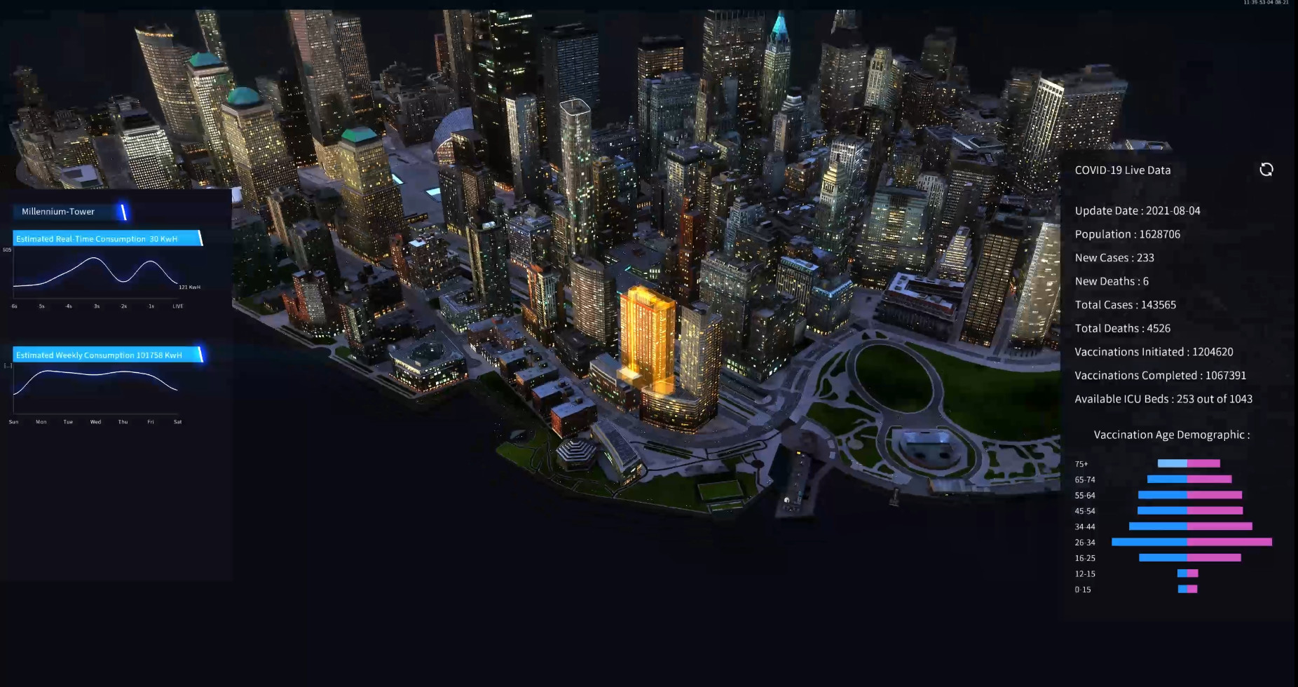
A city at your fingertips in interactive 3D
Valkyrie no-code creative platform allows cities to easily create cutting edge interactive dashboards and large-scale 3D data visualizations. Use life-like AR, Geo-positioning data and live video streaming as you consolidate data from multiple sources. Import BIM & GIS data directly and connect IoT sensors and video.
Using our industry specific templates, your designers can easily make immersive 3D experiences in real-time without endless video rendering and without any programming.
Visualize in your browser an example of what you can produce with Valkyrie: Launch Smart city app
Template
Our intuitive timeline-based interface streamlines production pipelines, allowing quick and easy mixing of multi-format digital assets into interactive designs and dashboards.
Download the smart-city template and use it to start building your own dashboard or present an MVP to the town council.
Go to template
Real-time Connectivity
Whoever the commissioner, whatever they want from an interactive dashboard, you can implement all your IoT specification requirements with Valkyrie:
- Real-time intelligence on the performance, positions and condition of real-world objects.
- Real-Time CCTV Playback is supported for all IP Camera Brands through the appropriate middleware.
- Internal and external video surveillance through MJPEG & RTSP protocol.
- Unify all feeds from Any BMS, PSIM, IoT system, Connectivity hardware, submeters…
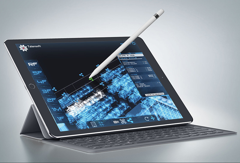
Cross-platform Capacity
Foster a collaborative experience within the supply chain by enabling everyone to use your apps from anywhere. Your digital twin and dashboard created with Valkyrie will run natively on:
- Windows & macOS desktop clients.
- Windows, Android & iOS mobile devices.
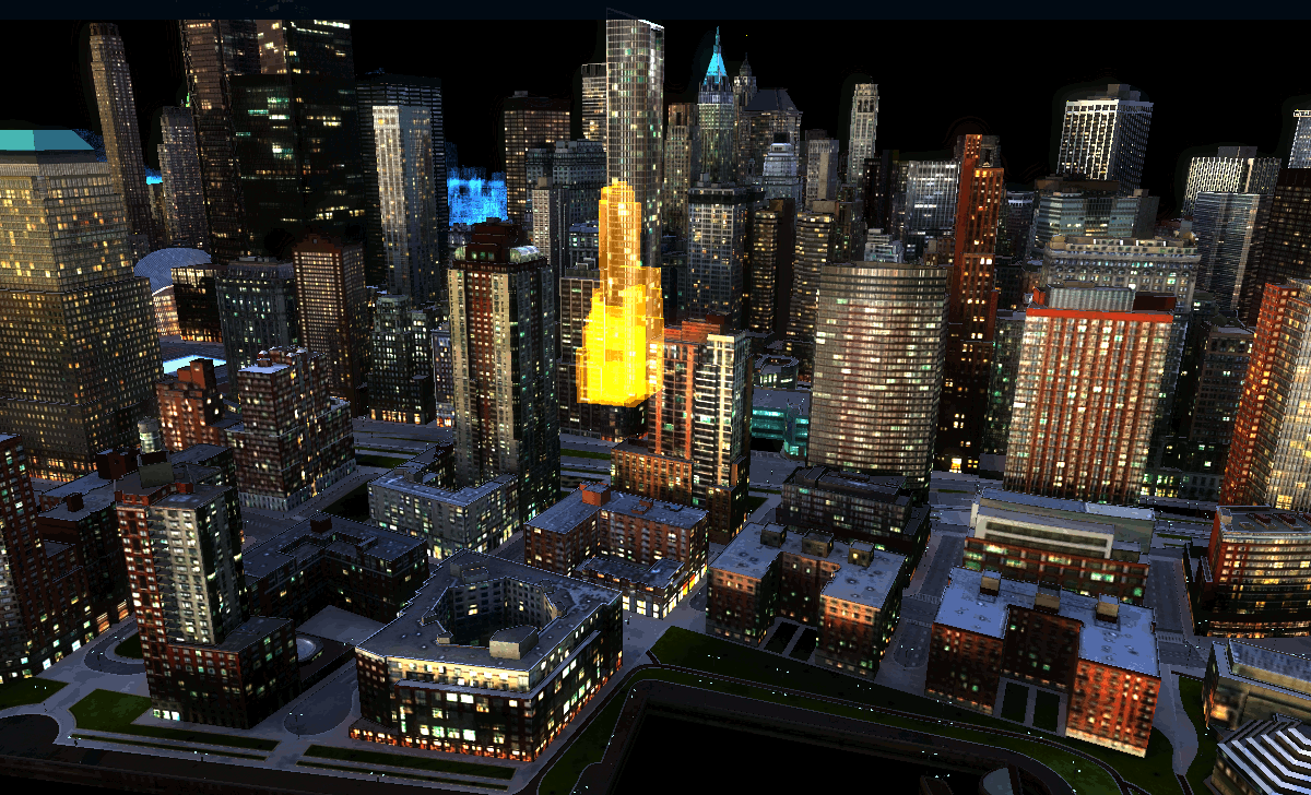
Realistic 3D Visualization
Valkyrie has a powerful rendering engine that allows you to obtain AAA real-time graphics. This will allow your clients to:
- Identify buildings and equipment instantly with high-resolution 3D models.
- Empower individual team members on quality management and facilitate geographic orientation.
- Promote training with virtual tours and situational simulations.
- Create multiple graphic modes: realistic, xRay and more.
Robust and versatile architecture
Implement your system with no technical or scaling restrictions:
- Unbelievably fast deployment.
- No technical limit to number of nodes, devices, or systems. Link as many as you need to manage your facilities.
- Set up multiple user levels with customizable credentials and authentication with our timeline-based interaction building system.
- Script system available for advanced data manipulation.